Warnings from history: Angkor was a thriving metropolis of 750,000 before a series of mega-monsoons made it unliveable. Can modern flood-threatened cities learn from its downfall?

After existing for more than a thousand years, the Mayan city of Tikal collapsed in the ninth century. At about the same time, halfway around the world, the city of Angkor was being founded. It would be the grand capital of the Khmer kingdom for six centuries before itself being abandoned.
The only contemporary account we have of Angkor is from a Chinese diplomat, Zhou Daguan, who arrived in 1296 and stayed almost a year. He tells us that the new temple of Bayon (all stone in what remains now, but still spectacular) had a gold tower, eight gold Buddhas, and a golden bridge flanked by gold lions leading to it. He writes of grand royal processions and firework displays, of a society with many slaves, open-air marketplaces with women vendors, and houses built of bamboo and thatch.
Angkor, the most extensive urban settlement of pre-industrial times, is now an archaeological park in northwestern Cambodia. Buses and trishaws ferry tourists between the ruins of some of the largest and most elaborate Hindu and Buddhist temples ever built. Some are only heaps of laterite blocks, but many are still astonishing: the towering lotus buds of Angkor Wat, the haunting Ta Prohm, in the clutches of time and strangler figs. Only recently have we begun to piece together how this and other ancient cities thrived and declined – their stories offer some intriguing lessons for cities today.
From our partners:

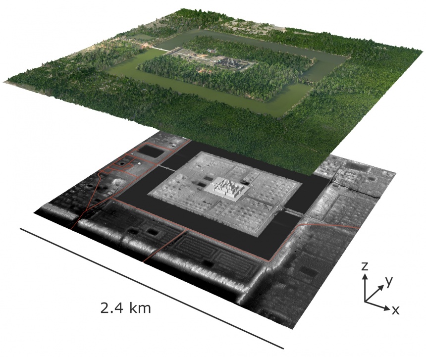
The true scale of Angkor as an urban settlement began to be confirmed around 20 years ago. The size and number of its temples turned out to be matched by the extent of the city around them. It was spread out over around 1,000 square kilometres – composed of temple complexes, large residential clusters and paddy fields irrigated by a canny network of reservoirs, canals, ponds and embankments. At Angkor’s peak, in the 12th and 13th centuries, some three quarters of a million people lived there.
Angkor – a name thought to be derived from “nagara”, the Sanskrit for “city” – was a low-density urban settlement, its population spread out owing to agricultural land being part of the city. This was a pattern of urbanism found in several ancient metropolises, including the Mayan cities of central America, and Sri Lankan cities such as Anuradhapura and Polonnaruwa.
These cities all went into decline relatively soon after attaining their prime. Angkor was flourishing in the late 13th century when Zhou Daguan visited; a little over a century later, it was all but abandoned. Researchers are beginning to see similarities in how these ancient low-density cities failed – and this is of particular interest today because, even as our cities grow in extent and population, their densities are falling.
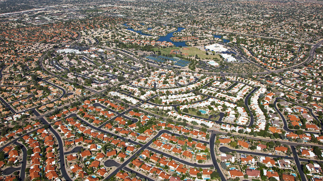
“Almost all cities are dropping to extremely low density,” says Roland Fletcher, professor of theoretical and world archaeology at the University of Sydney. “For example, the middle of New York may be very crowded, but Greater New York is a vast, sprawling landscape with huge amounts of open land which are never out of sight of buildings.”
A similar pattern repeats with Greater Shanghai, Greater Tokyo, and the larger American and European agglomerations. The phenomenon of urban sprawl has largely been seen as a consequence of industrialised urbanisation: the availability of cars, outrageous real estate prices close to city centres, suburban aspirations of the middle class. But as Fletcher points out, there is nothing new about low-density cities.
He recalls delivering a talk in 1996 about pre-industrial cities at the Smithsonian National Air and Space Museum in Washington DC. Someone asked him at the end of his talk if he’d seen radar imagery of Angkor taken from the space shuttle Endeavour. Fletcher had the image within a week, and the first thing he noticed was something that had been speculated to exist – “this whacking great canal coming down from the north”. The area with the temples proved to be just the centre of Angkor: “There were lines and patches and tanks and features all over the place. The immediate revelation was that this place was huge.”

Fletcher went to Cambodia in 1998 where he met Christophe Pottier of the École Française d’Extrême-Orient, riding around on a motorcyle to map Angkor. When Pottier pulled out his maps, says Fletcher, “If you didn’t know what it was, you’d think it was a Mayan city.”
The pair teamed up to form the Greater Angkor Project, a Cambodian-French-Australian initiative that aimed to produce a detailed map of greater Angkor and investigate the reasons for its demise. They used high-altitude remote sensing technology to find urban forms concealed by forest cover, and conducted surveys and ground excavations.
There had long been a debate about what led to the decline of Angkor and the southward move of the Khmer seat of power. Proposed explanations included the strain on theocratic rule of Hindu-Buddhist jostling; attacks by Thai armies; and changes brought about by maritime trade. But the Greater Angkor Project added a significant new possibility: extreme climate instability. Analysis of tree rings in neighbouring Vietnam showed long periods of droughts followed by periods of unusually wet monsoons in the 14th and 15th centuries.

The upheaval caused by flooding during mega-monsoons is clearly visible in remote sensing images produced by the project: erosion channels show rapidly moving water breaching a dam, crashing into the wall of a reservoir, then tearing away the edge of a residential area, flowing at a high level through housing, and later damaging a bridge. Perhaps the scenes in Angkor were not very different from those seen in recent years in New Orleans or Fukushima.
Sand accumulated in Angkor’s canals, and parts of the water network were cut off from each other. Damage to an old, complex water management system meant the city became less resilient in intervening periods of drought. Angkor, with its large population and broken infrastructure, would have found it hard to sustain itself.
The pattern of urbanism at Angkor was hardly unique: the Mayan cities that Pottier’s maps of Angkor reminded Fletcher of have long been recognised as low-density agrarian settlements. The lack of the wheel and the absence of draught animals meant that large quantities of food could not be transported, and cities had to be largely self-sufficient, growing maize, varieties of beans, squash, manioc and other staples of the region.
The city of Tikal, in present-day Guatemala, was one of the most important of these Mayan centres. In what is called its Late Classic Period, around 600 AD, there was a flowering of art and architecture: large plazas, palaces, pyramid temples, sculpture and painted ceramics (of the many structures still found in Tikal, a 65-metre high pyramid is one of the tallest man-made structures in all pre-Columbian America). Conservative estimates put the city’s population at around 45,000 during this period; the city extended over 160 square kilometres. Then, in the middle of the ninth century, Tikal collapsed.
Just how a large population was sustained, and then came undone, in the middle of a rainforest has been reconstructed in recent inter-disciplinary work by a team of researchers from Mexico, Guatemala and the United States. David L Lentz, professor of biological sciences at the University of Cincinnati, says: “We now have empirical data to tell you what the landscape looked like.”

Originally, the area of Tikal was around 70% upland tropical rainforest, and the rest swampy wetland. An extended family would build their houses in a cluster, with cultivable land attached. In all, the people of Tikal cleared around two-thirds of the rainforest to create their monuments and homes, and to fuel their fires. “In many ways they were managing the forest very effectively,” says Lentz. “But they weren’t aware that cutting down a forest reduces the amount of precipitation in the region. Then suddenly a horrible drought comes along, and they can’t figure out why they can’t supplicate their gods adequately to prevent it.”
It didn’t help that Tikal’s water management system had become increasingly reliant on collecting rainwater in reservoirs, at the cost of groundwater. “As Tikal grew and grew,” Lentz says, “they created all these pavements around the city, from which they’d divert water to the reservoirs. But this cut off the recharge capacity of the springs. When there was no longer any rainfall to fill up their reservoirs, the springs had dried up too.”
For centuries, the Maya at Tikal had been erecting stelae – upright stone slabs with hieroglyphs and depictions of gods and rulers. The last one is dated 869. Soon after, there are signs of what might today be called urban decay, with palaces being occupied by squatters. Charred, gnawed human bones from this late period suggest desperate times. Then, the city went quiet.
Tikal’s over-use of forested land ended up exacerbating the drought in the ninth century, and their construction compromised the city’s back-up source of water. Both are familiar refrains from analyses of cities today. “They did at least two things that changed their environment in significant ways,” Lentz says. “This ultimately led to their demise. In the big picture, Tikal serves as an excellent model of us today, because we’re following the same trajectory.”
Tikal had a population explosion in the seventh century and continued to adapt. “But they ran all of the resilience out of the landscape. Then, when the rains didn’t come, they had no way to respond and the whole thing collapsed.”
Lentz draws a comparison with a neighbouring city called El Zotz, which had a smaller population, which didn’t modify its landscape as drastically, and was thus able to survive the drought that felled Tikal.

In the ancient world, low-density cities were prone to episodes of collapse. But back then, only a minuscule fraction of the world’s population lived in cities. According to Fletcher: “It’s now generally reckoned that 50% of humankind lives in cities, a lot of which are relatively low density. In less than 200 years we’ve created a physical situation for millions and millions of human beings that has never existed before. It’s completely unprecedented. We should probably take a fairly hard look at it.”
Tikal, Angkor and Anuradhapura (which foundered in the 10th century after thriving for more than a millennium) were very different cities in their geography, environment and social and political functioning. But, Fletcher points out, they all had operational similarities: extensive land clearance, sprawling low-density settlement patterns, massive infrastructure – all of which are attributes of modern cities. The extended infrastructure of Angkor and Tikal proved vulnerable to a changing climate, something else that may be upon us.
“Whatever the cause of climate change, we’re in it,” says Fletcher. “And this fluctuation is getting serious.” He points out that events like the flooding of New Orleans have resonances with Angkor: “Both cities had developed a fantastic method of managing water. But if the impact that comes is outside the parameters of the system, you’re in trouble.”
This article originally appeared in The Guardian.


